79 WHITMAN RD
Owner Information
CAREY FAMILY REALTY TRUST;
73 WHITMAN ROAD
WALTHAM, MA 02453-6969


Property Details
79 WHITMAN RD is classified as a Single Family Residential (Ranch).
The primary structure on this property was built in 1955. There are 1,451ft2 of built area within this property. There is 1,451ft2 of residential/living space within this property. This property is listed as having 6 rooms.
79 WHITMAN RD is valued at $566,700. The land is valued at $372,800 and the structures are valued at $193,900.
The most recent deed for 79 WHITMAN RD is recorded at the local registrar in Book 1349, Page 54. 79 WHITMAN RD was last sold on Tuesday, January 22, 2008 for $1.
Assessment data from fiscal year 2022.
Flood Data
According to the FEMA National Flood Hazard Layer, this property does not appear to be in a flood zone. It may also be in an area not yet reviewed. Nonetheless, confirm this information prior to taking any action.
To view the flood hazards around this property, create a FEMA "Firmette" Map of the area around 79 WHITMAN RD.
Broadband Internet Providers
| Provider | Type | Bandwidth (mbps) | |
|---|---|---|---|
| Comcast | Cable | 1000 | 35 |
| VSAT Systems, LLC. | Satellite | 2 | 1 |
| HughesNet | Satellite | 25 | 3 |
| GCI Communication Corp. | Satellite | 0 | 0 |
| RCN | Cable | 500 | 20 |
| Verizon New England Inc. | Fiber | 940 | 880 |
| Verizon New England Inc. | DSL | 5 | 0 |
| Viasat Inc | Satellite | 100 | 3 |
Broadband service provider data from December 2020.
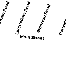
Adjacent Properties
- 83 WHITMAN RD
Single Family Residential owned by DOOLEY, JOHN J., JR. & - 80 LONGFELLOW RD
Single Family Residential owned by BROOKS, JOANNE M. - 73 WHITMAN RD
Single Family Residential owned by CAREY FAMILY REALTY TRUST; - 70 LONGFELLOW RD
Single Family Residential owned by GUCCIARDI, MICHELLE J. & - 74 LONGFELLOW RD
Single Family Residential owned by JACKSON, ERIC & RYLEE F.